Create a 3D cycling route animation
A route animation can make a road ride, mountain-bike loop, climb, or descent easy to follow. Flyover uses your GPS track to draw the route over 3D terrain, then gives you camera, scene, photo, panel, and export controls for a film that matches the ride.
Monte Peller flyover demo
One ride through Monte Peller, with photos on the route, changing weather, and creative styles.
Connect ride photos to places on the map
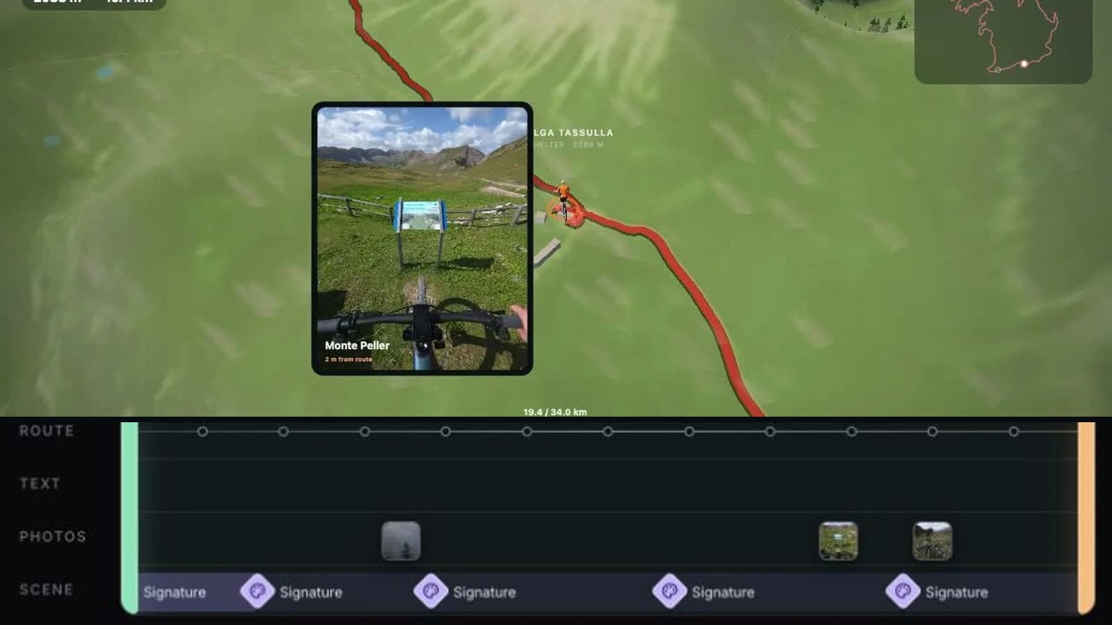
The map shows where you rode; your photos show what the ride felt like. Place images from a climb, viewpoint, or finish at the corresponding route stops. The Monte Peller demo brings the route, photo stops, and changing light together in one film.
Show climbs, descents, and terrain deliberately
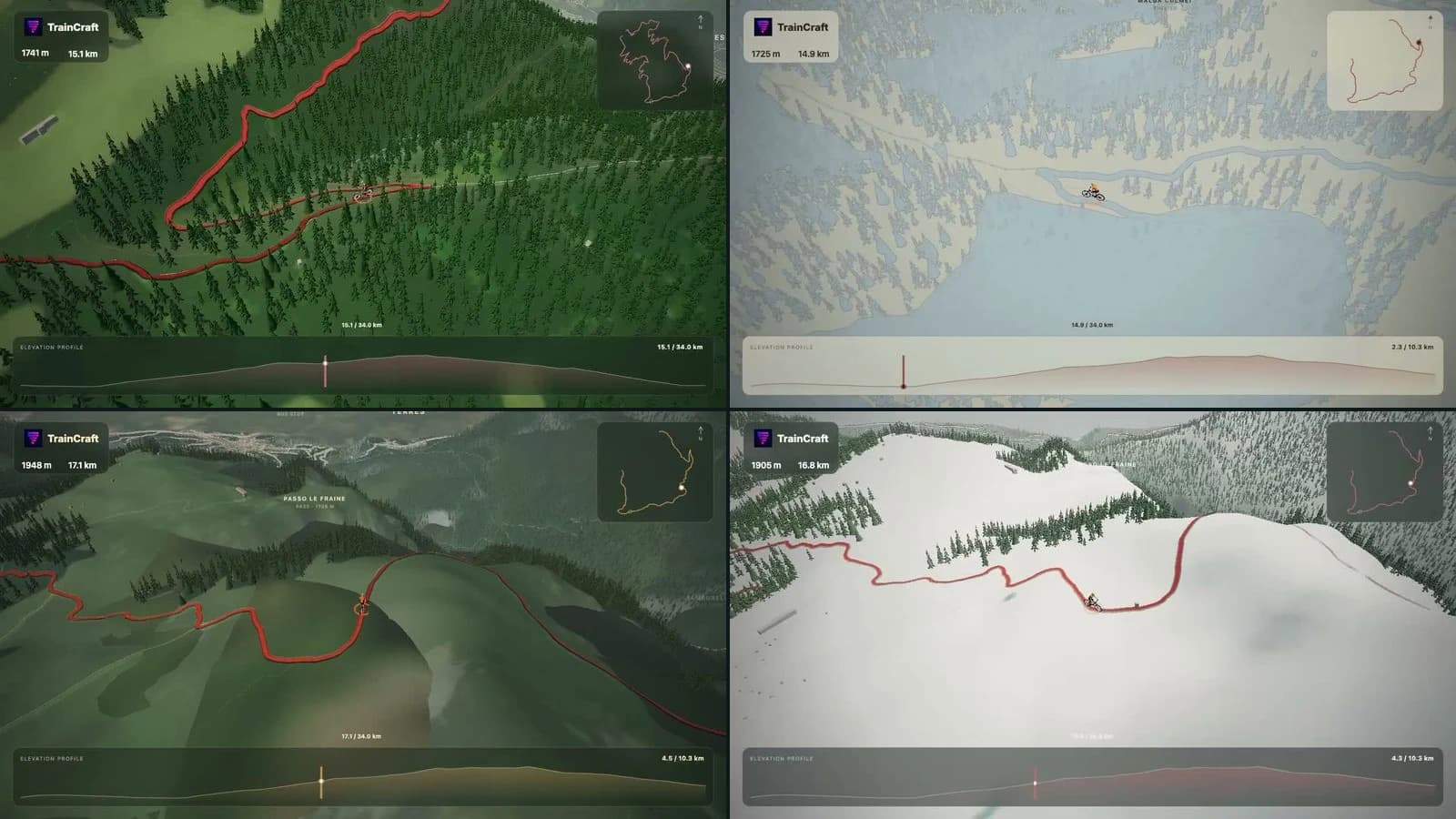
Use follow and predictive views for direction, cinematic and drone views for terrain, or an orbit for a stop. Bring in map and elevation panels when the profile matters, then use appearance keyframes to change camera, style, intensity, weather, time, season, and panels along the ride.
Compose for the post you plan to share
A landscape frame can give the route and elevation room to breathe. A native 9:16 MP4 is available for portrait Reels; 1:1 and 4:5 are also available. Select 30 or 60 fps and 720p, 1080p, or 1440p in export settings.
Open Flyover StudioControls for a cycling story
- Map a road or MTB ride from a GPS track over 3D terrain.
- Use six camera modes: follow, predictive, cinematic, drone, orbit, and overview.
- Show route and elevation panels where a climb or descent needs context.
- Set editorial weather, light, season, camera, and style keyframes across the ride.
- Export a landscape or native portrait MP4.
Build a cycling route animation
- 1Upload the GPS file for your road or mountain-bike ride.
- 2Mark photos and tune cameras, terrain appearance, weather, and panels around the route story.
- 3Select the final aspect ratio and export the completed MP4.
FAQ
Can I animate a road ride and an MTB ride?
Yes. Upload a GPS track for either type of ride and edit the route presentation for its terrain and story.
How can I make a climb clearer?
Use terrain framing with map and elevation panels, then choose a camera that keeps the route readable through the climb.
Can daylight and weather change during the ride?
Yes. Use appearance keyframes to schedule changes in weather and time of day along the route. These are editing choices; weather is not reconstructed automatically from the GPS file.
Can I add photos to a cycling route video?
Yes. Upload your own photos and place them at the corresponding timeline stops. The flyover presents each image in the context of the route.
Can I export a vertical cycling video?
Yes. Choose native 9:16, or select 16:9, 1:1, or 4:5, then export an MP4 at 30 or 60 fps.