Make a 3D flyover video from your COROS activity
Recorded a ride, run or hike on a COROS watch? Export the activity as a FIT file from the COROS app, upload it to Flyover, and fly the route over 3D terrain. Then export the result as an MP4. Flyover works from the file you upload; it does not connect to your COROS account.
What a COROS file brings to the map
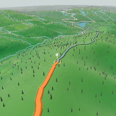
The GPS track draws the route over 3D terrain with route progress and an elevation panel. A FIT file from a COROS watch can also carry heart rate, power or cadence; the panels show those values only when the file includes them.
A finished scene sequence from one route
For activity recaps and route previews, Auto Story uses route shape, climbs, descents, and supported activity moments to produce an ordered sequence you can review scene by scene and edit in the same Studio.
In the COROS app, open the activity, tap the three dots in the top right corner, choose Export and select FIT. Send the file to your computer by email, AirDrop or another method.
The GPS track draws the route over 3D terrain with route progress and an elevation panel. A FIT file from a COROS watch can also carry heart rate, power or cadence; the panels show those values only when the file includes them.
Choose 16:9, 9:16, 1:1 or 4:5 at 30 or 60 fps and export an MP4. The free export is 720p with stylized terrain and a TrainCraft watermark; 1080p, 1440p, satellite imagery or an export without the watermark need a paid export.

Add photos from the activity
Place your own photos at the matching points of the route, such as the summit, a viewpoint or the finish, so each picture appears where it was taken.
Export the COROS flyover as MP4
Choose 16:9, 9:16, 1:1 or 4:5 at 30 or 60 fps and export an MP4. The free export is 720p with stylized terrain and a TrainCraft watermark; 1080p, 1440p, satellite imagery or an export without the watermark need a paid export.
Open Flyover StudioFrom the COROS app to a 3D video
- Upload the FIT file exported from the COROS app (GPX and TCX files work too).
- See the route over 3D terrain with route and elevation panels.
- Show heart rate, power or cadence panels when the file includes them.
- Add photo stops and set camera and scene keyframes.
- Export a new MP4 in the aspect ratio you choose.
Make a COROS 3D flyover
- 1In the COROS app, open the activity, tap the three dots in the top right corner, choose Export and select FIT. Send the file to your computer by email, AirDrop or another method.
- 2Open Flyover and upload the file.
- 3Add photos, tune the camera and export the MP4.
FAQ
Which COROS files can I use?
The COROS app exports activities as FIT files, which Flyover reads. GPX and TCX files with a usable GPS track work too. An activity without GPS coordinates cannot draw a route.
Does Flyover sync with my COROS account?
No. COROS activities come in through a FIT file that you export and upload (GPX and TCX files work too).
Is there a COROS 3D flyover app, and is it free?
Flyover is a browser tool from TrainCraft, not a COROS app or feature, so there is nothing to install. The free export is 720p with stylized terrain and a TrainCraft watermark; 1080p, 1440p, satellite imagery or an export without the watermark need a paid export.
Does it work for runs and hikes as well as rides?
Yes. Any COROS activity with a usable GPS track can be flown, and heart rate or other sensor panels appear only when the file includes that data.
Are COROS and TrainCraft affiliated?
No. COROS is a trademark of its respective owner. TrainCraft is an independent service and is not affiliated with, endorsed by or sponsored by COROS.